The proposed motorway connection between Sydney’s M1 and M2 motorways has seen various incarnations since it was originally planned in the 1970s, but a common thread between the proposals has been a gradual drift away from common sense.
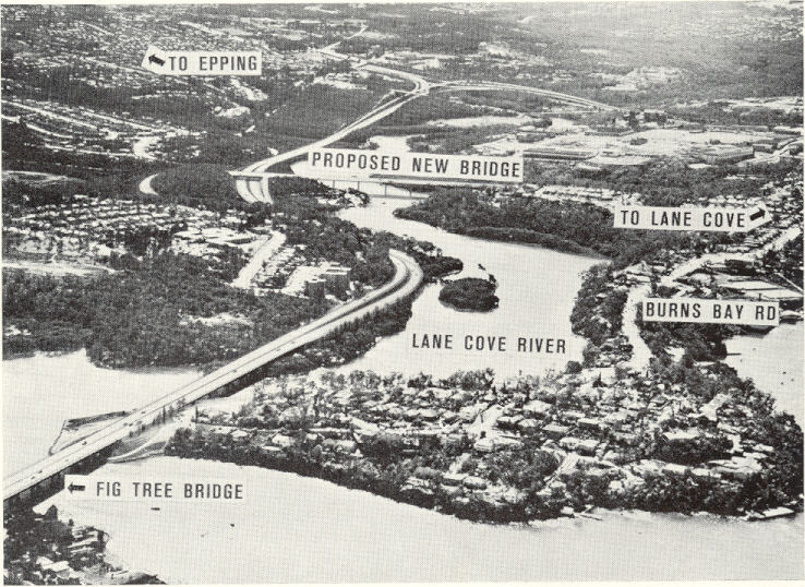
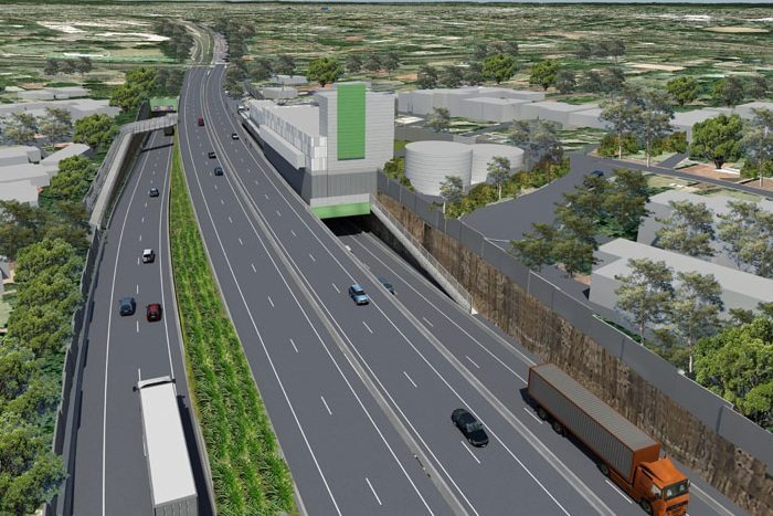
An artist’s impression of the proposed Lane Cove Valley Expressway at East Ryde (Image: OzRoads)
Originally planned as the Lane Cove Valley Expressway in the 1970s, the New South Wales state government’s plan was to build a road extending from the Gladesville Bridge up into the Lane Cove National Park towards Marsfield, from where it would split into two sections; one being the Sydney – Newcastle Expressway and the other being the North Western Freeway or Castlereagh Expressway, bound for Blacktown and then on to Richmond. This idea was scrapped in the late 1970s, and with good reason – the destruction of Lane Cove Valley bushland would have represented a blight on the city’s northern green space, and planning for the Harbour Bridge / Gore Hill Freeway corridor was well underway, negating a need for traffic to be diverted through Sydney’s inner west.
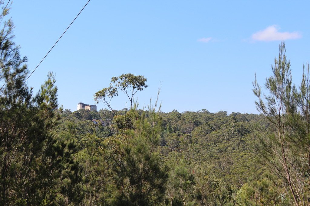
Bushland between Fox Valley and South Turramurra, seen from near Canoon Road. This tract of forest would have hosted the B2/B3 corridor before its abandonment in 1995.
The B2/B3 corridor at Eastbourne Avenue, Wahroonga. The vacant piece of land on the right is where the motorway was once planned to be built.
When the southerly section of the Sydney – Newcastle Freeway was built in the mid-1980s, talk continued about a southerly extension of the road, along a controversial piece of land known as the B2/B3 corridor. This would have followed a similar path to the proposed Lane Cove Valley Expressway, but the public’s attention was brought to the road’s proximity to houses adjacent to the B2/B3 corridor, in Fox Valley and South Turramurra. The land comprising the B2/B3 corridor was abandoned in 1995 to preserve the bushland in this area. However then, under the Carr government, little else was offered to relieve growing traffic volumes on the Pacific Highway and Pennant Hills Road.
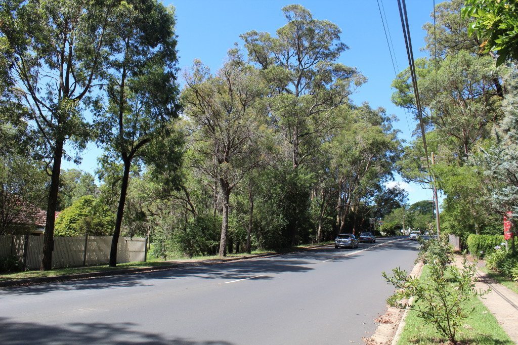
The B2/B3 corridor at Fox Valley Road, Wahroonga. The vacant piece of land on the left is where the motorway was once planned to be built.
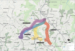
Type A Options for M1/M2 connector (Image: Infrastructure Application Report, Roads and Maritime Services, NSW Government, September 2013)
In 2004, under the Labor state government, several options were put forth in a study by engineering firm SKM to connect the M2 Motorway and the F3 Freeway (henceforth referred to by its current name, the M1 Pacific Motorway). These options covered four main routes known as;
- the Red Option (a tunnel under Warrawee Valley and South Turramurra)
- the Yellow Option (a tunnel under the original B2/B3 path in Fox Valley)
- the Blue Option (a tunnel skirting the Lane Cove Valley under Thornleigh and Pennant Hills)
- the Purple Option (a tunnel under Pennant Hills Road and/or the Northern Railway line)
From these, and after community consultation, the Purple Option was selected due a variety of reasons;
- the need to reduce traffic and particularly heavy vehicle traffic on Pennant Hills Road.
- the need to provide a Sydney bypass for motorists travelling between the M1 and the M5 (towards Goulburn).
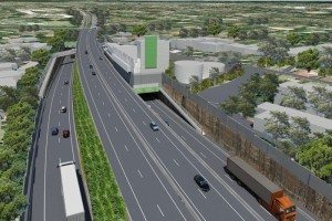
An artist’s impression of the NorthConnex interchange with the M1 at Wahroonga near Edgeworth David Avenue (Image: NorthConnex)
This proposal, currently named NorthConnex, has now advanced to the planning stage, and in March it was announced that the contract to build the motorway had been awarded. This is problematic for a variety of reasons, outlined below.
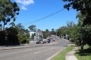
The M1/Pacific Highway interchange at Wahroonga
Pacific Highway ignored
The current plan does not address the issue of rising traffic on the Pacific Highway. Traffic arriving from the Central Coast bound for Sydney’s CBD currently travels along the Pacific Highway through Turramurra and Gordon. Sydney’s North Shore is experiencing a rise in population after progressive apartment developments, along with ongoing suburban development on the Central Coast. All of this contributes to congestion on the Pacific Highway, and on the North Shore train line. SKM’s 2004 study even highlighted the fact that a majority of through traffic exiting the M1 at Wahroonga travel along the Pacific Highway, rather than along Pennant Hills Road (see diagram below). Unless Central Coast commuters find employment in locations other than Sydney’s CBD and North Shore, logic dictates that congestion on both road and rail networks will increase as the population does, and in line with the natural growth of the labour market in Sydney City.
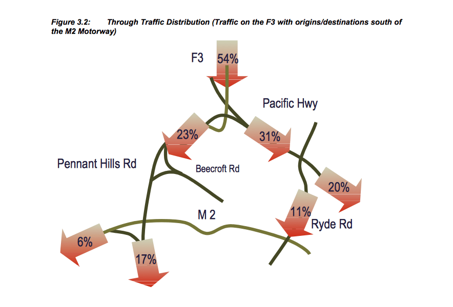
A diagram showing through traffic distribution from the M1 (or F3 as it was then known). This diagram, shown in SKM’s F3 to Sydney Orbital Link Study, clearly demonstrates that more traffic from the M1 travels along the Pacific Highway rather than along Pennant Hills Road. (Image: F3 to Sydney Orbital Link Study, SKM 2004)

NorthConnex’s indirect route to the city (Image: Sydney Morning Herald)
NorthConnex does not provide a solution to this problem for two reasons; firstly, and most obviously, the road travels southwest from the end of the M1 at Wahroonga, heading away from Sydney’s CBD, before allowing motorists to joint the M2. While this is undoubtedly attractive to commuters travelling from the Central Coast to Western Sydney, it is unlikely that a motorist would happily pay a toll to be taken to from Wahroonga to Sydney via Carlingford.
This is compounded by the fact that under the current proposal, NorthConnex would only have a direct connection to the M2 westbound. Motorists who travel to Sydney on NorthConnex would have to rejoin Pennant Hills Road in Carlingford, before making a left hand turn on to the M2 at the existing set of traffic lights – and pay a steep toll for the privilege.
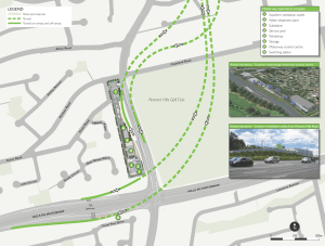
A diagram of NorthConnex’s southern interchange, demonstrating the difficulty in making a southbound/eastbound or a westbound/northbound connection between NorthConnex and the M2 (Image: NorthConnex)
The same is true in reverse, for motorists on the M2 travelling between the city and the Central Coast, who would need to exit the M2 motorway and turn right at a set of traffic lights, rejoin Pennant Hills Road and then enter the NorthConnex tunnel. Therefore, even someone travelling between the city and the Central Coast who could overlook the diversion via Sydney’s northwest and NorthConnex’s hefty toll, would be punished for taking the route by being dumped back onto Pennant Hills Road while traffic bound for Western Sydney would flow on through.
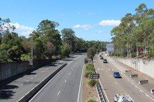
Looking north along the M1 at Wahroonga
With NorthConnex built, there would remain little scope for a further motorway project on Sydney’s North Shore, and successive state governments have demonstrated their reluctance to invest in public transport. While the Purple Option was undoubtedly attractive to North Shore residents who don’t want a tunnel running under their suburbs, it unclear how desirable continued traffic congestion on the Pacific Highway and crowded North Shore commuter trains without any alternative would be.
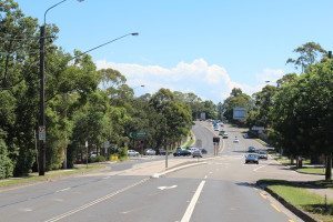
The current end of the M1 on Pennant Hills Road at Wahroonga/Normanhurst
Dangerous goods, other traffic remains above ground
In line with most major road tunnels, NorthConnex will not allow passage to trucks carrying dangerous goods, meaning that the dangerous materials will continue rumbling along suburban Pennant Hills Road. Exactly how a Pennant Hills Road resident is supposed to feel comforted about this fact remains unanswered. Additionally, a state government website boasts that fifty percent of heavy vehicles and thirty per cent of light vehicles are forecast to use NorthConnex. The economics of building an $3bn road tunnel for only thirty per cent of cars and fifty per cent of trucks doesn’t seem to add up, and that’s if motorists opt for NorthConnex at all; New South Wales’ experience with the Cross City Tunnel demonstrated that traffic forecasts aren’t always realised.
Redundant due to M9 development?
The reason for the choice of the Purple Option is often cited as providing a link in Sydney’s Oribtal Road network, therefore providing a link for vehicles wanting to avoid Sydney altogether. From south to north, vehicles would be able to travel along the M5 Hume Freeway, then join the M7 Westlink near Liverpool, travelling around Sydney’s northwestern perimeter, then veering north at Carlingford through NorthConnex and on to the M1 at Wahroonga bound for Newcastle
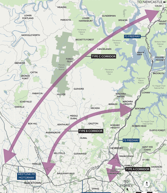
Type A, B and C corridors were considered in the 2004 SKM report for the M1/M2 connector, however the Type A corridor was considered the most effective, thus giving rise to the four ‘colour’ options outlined earlier. (Image: Infrastructure Application Report, Roads and Maritime Services, NSW Government, September 2013)
However this is at odds with the New South Wales government’s long-term strategy of developing an Outer Orbital Road, also called the M9 (see map below left). The Outer Orbital Road would bypass the metropolitan area almost completely, departing from the M5 at Campbelltown, swinging out west past Penrith towards Windsor or Richmond. It would then proceed across the Hawkesbury River between Spencer and Wiseman’s Ferry, joining the M1 somewhere west of Gosford. The M9 is an excellent long-term project in that it provides the near total Sydney bypass that motorists would require. It also provides the second Hawkesbury River crossing that has been discussed for years, offering an alternative route if the M1 is closed by bushfire or some other incident, as often occurs (the need for a second Hawkesbury River crossing is briefly explained on page 7 of this document, part of SKM’s 2004 report). But the question must then be asked if it would render the NorthConnex redundant in its originally
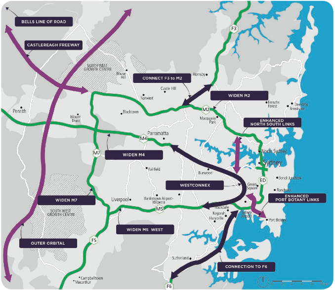
Sydney’s long term road transport plan (Image: Sydney’s Long Term Transport Master Plan, NSW Government, December 2012)
stated aim, that is to complete the bypass of Australia’s biggest city. A Brisbane motorist bound for Canberra or Melbourne would logically take the M9 at Gosford to bypass Sydney altogether, rather than negotiate the traffic of the M1 near Wahroonga, NorthConnex, the M2 through the Hills District and then the M7. Thus the connection between the M1 and the M2 logically becomes a north-south connection, allowing motorists a fast link to Sydney or Western Sydney from the Central Coast and beyond. This is also in line with the M1’s new designation as the Pacific Motorway, a link between Sydney and Brisbane to complement the Pacific Highway (much as the motorway-standard Hume Motorway has complemented and replaced much of the old Hume Highway between Sydney and Melbourne).
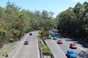
The final stages of the M1 at Wahroonga
What next?
It is clear that the NorthConnex motorway will struggle to achieve its aims of providing a long-term solution to heavy traffic on Pennant Hills Road; it is doubtful that any type of motorway will do this. A potential solution to this would be to offer a respectable and affordable public transport option to the seventy per cent of cars that are forecast to avoid NorthConnex. This could be done through additional high-capacity, high-speed train services from the Central Coast to Strathfield, Parramatta and beyond into Western Sydney. Commuters who travel between points on Pennant Hills Road could benefit from more regular bus services, making more frequent stops and strategically timed to meet express train services. Similar services could be offered on the North Shore line with the aim of alleviating traffic congestion on the Pacific Highway.

Chatswood statation in peak hour; trains will only become more crowded with an increase in population, and public transport must be part of the solution (Image: Sydney Morning Herald)
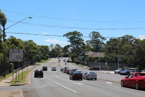
The Pacific Highway/M1 interchange at Wahroonga
There’s no doubt that some form of road link is required between the end of the M1 at Wahroonga and the M2, to relieve pressure on other major arteries and to complete the national highway network’s passage through Sydney; travellers heading towards Sydney from northern NSW or Brisbane should not drive hours on motorway-standard road through rural areas, only to be dumped on to local roads once they reach Sydney. However the route that the road should take is crucial. It’s clear that NorthConnex is not only short-sighted in this regard (as it will eventually be superseded by the M9), but it will not solve ongoing traffic issues on the Pacific Highway, and will only slightly help the situation on Pennant Hills Road.
A better option to relieve pressure on the Pacific Highway would be to offer an alternative; that is, to provide the city-bound onramps between NorthConnex and the M2 at Carlingford with the aim of attracting motorists trying to avoid bottlenecks at Turramurra and Chatswood.
It’s most likely too late now, but it goes without saying that the Yellow Option would have achieved this more effectively by cutting kilometres of tunnel out of the journey and operating as an alternative to the Pacific Highway as well as Pennant Hills Road. An interchange in North Epping could have provided both city-bound and west-bound connections, meaning that the M1 would cater for Central Coast traffic heading into the city as well as to the western suburbs. Importantly, a similar proposal was put forth in 2005 by motorway operators Transurban for similar reasons, as discussed in this 2007 Sydney Morning Herald article, however details of that proposal seem difficult to find online.
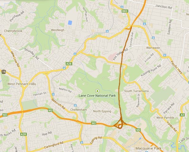
A revised yellow option, travelling deep underground to avoid disturbing houses in Fox Valley, and with a relatively small interchange at the southern end, offering motorists options to transfer in all directions between the M1 and the M2. The depth of the motorway could also remove the need for a surface component in the Lane Cove National Park by diving beneath the river. Alternatively, if a surface component was required, this could be achieved with tunnel portals deep in the valley, emerging simply to cross the river, then entering tunnel again on the facing valley wall. (Image: Google)
Additionally, the yellow option would have operated as a tunnel under tracts of bushland, meaning that compared with NorthConnex’s plan, less homeowners would have a major motorway running beneath their houses. The topography of the area is no doubt a challenge (the Lane Cove National Park is much more rugged than the Pennant Hills Road corridor) and would increase the cost of building such a tunnel, but surely that increase is more easily justified than $3 billion wasted on the current ineffective proposal.
Sadly, it seems that the New South Wales government is set to repeat the mistakes of the past by spending millions of dollars on a white elephant. While pre-1990s proposals of a motorway cutting through protected Lane Cove Valley bushland are clearly unacceptable, the people of northern Sydney need to consider what they want from their government; tax money spent on a NIMBY alternative, or an combined public transport-motorway strategy which could have a real impact on the traffic volumes on both Pennant Hills Road and the Pacific Highway.
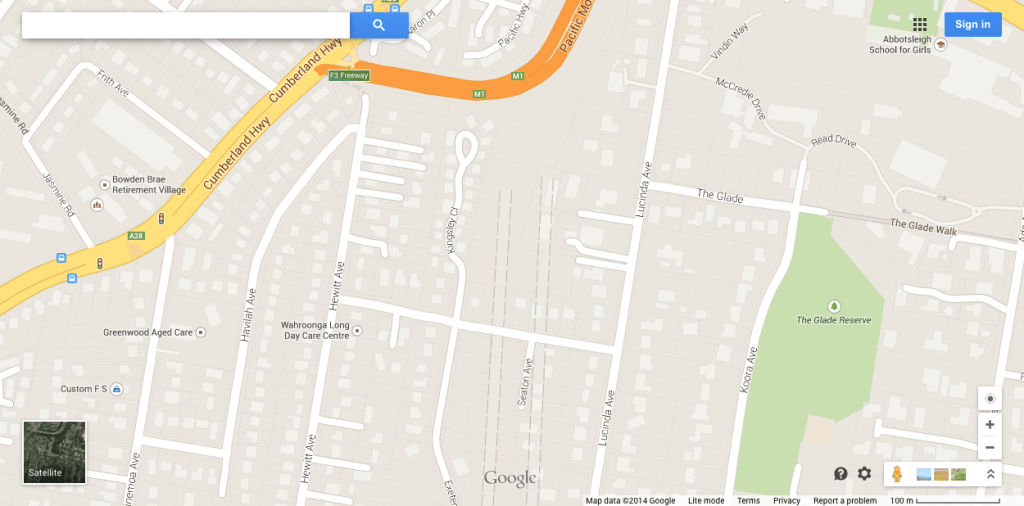
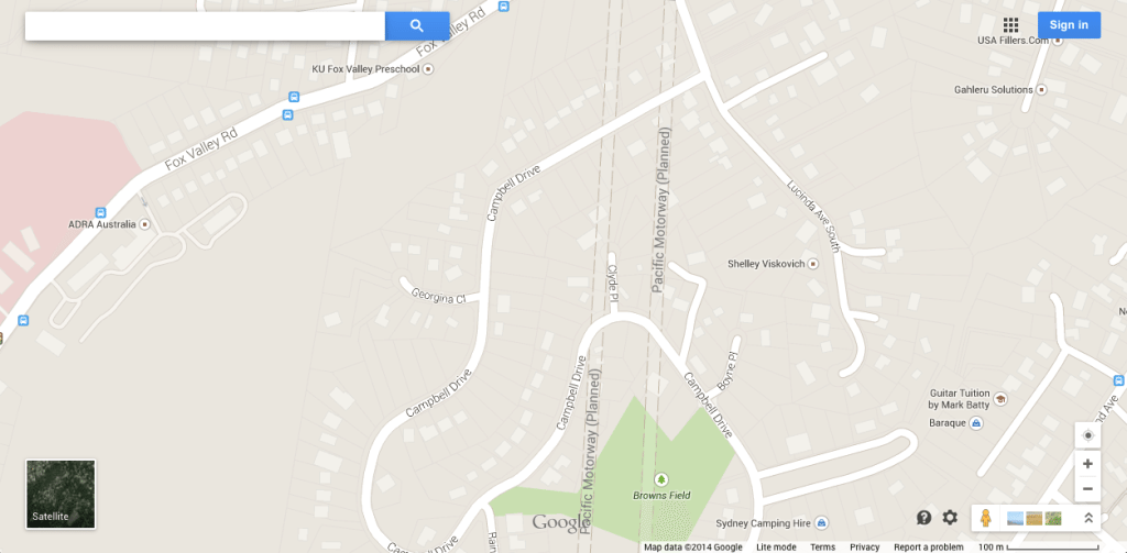
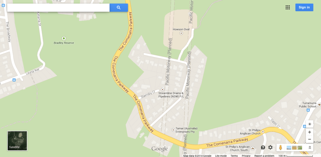
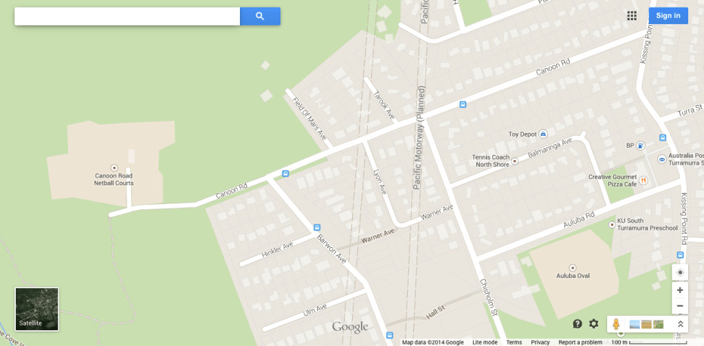
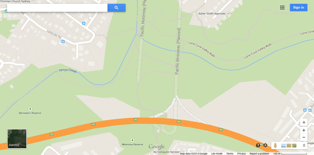
NB: Interestingly, although probably not significantly, as of 2nd May 2014 Google Maps illustrates a proposal running directly below houses in Fox Valley and South Turramurra, between the proposed Yellow and Red Options of 2004 (the ‘Orange Option’ perhaps?). See images below.



The NorthConnex ‘preferred’ plan appears to be very rushed with no real consideration of the impact on the health eg of 9,000+ school students within 1.5km radius of the unfiltered northern portal and ventilation shaft. It is a short term ‘cheap solution’ with serious long term physical and mental health effects that have been substantiated by medical research. Considering the current revelations about developer $$$ for Liberal party ‘favours’ one does wonder if there is more to this rushed plan than meets the eye???
Thanks for reading Elizabeth! It certainly does seem to be moving quickly, after years of inaction. It does make you wonder!
Your diagrams make it really obvious that the Northconnex tunnel is needed by Transurban to ‘feed’ their M2 tolls. The M9 will greatly reduce the traffic on the M2 but the new tunnel will double their opportunity to charge a toll. It explains why Northconnex was an unsolicited proposal!
Thanks for the insight.
I have linked to your article https://www.facebook.com/StopTheStacks
Thanks for reading, and thanks for the link!
The purple route reduces Pacific Highway traffic ,65,000 vehicles per day, by only 2′,000. Vehicles per day, including 300 commercial vehicles per day.
Building city-bound branch tunnels at the southern end would require about two kilometres of tunnels similar to the yellow option south end. Using Perlmans tunnel cot of $400million per km of two lane tunnel would cost$800 million. It would be a fraction of that price to build the F3 freeway along the B3 route, costed as the RTA preferred route in 1988 at $ 117 million. With the small change left over, a four lane arterial could be built up Terry’s creek to Blaxlend Road atEastwood.
Yes, building citybound tunnel-ramps on to the M2 under the purple option would be expensive, and as I mentioned in my piece, it’s debatable whether motorists would want to travel from Wahroonga to the CBD via Carlingford, and be charged for the privilege. Thanks for reading and contributing.
One factor enabling a speed up of northconnex could be the removal of Nick Greiner and Paul Broad from the top of Infrastructure New South Wales.
Back in 1988, the RTA preferred route was the”B3″ surface route, at a cost then of $117 million, and a benefit/cost ratio of 4.1, and the loss of about 30 houses along the route, which had been reserved for a couple of decades. Nick Greiner had his family home in the vicinity of Lucinda Avenue, and promised his neighbours the f3 freeway extension would not be built while he was in power.
The B3 freeway route happened to be in his electorate, and I would imagine his neighbours provided him with electoral support.
An alternative surface route in competition with the B3 was the widening of Pennant Hills Road. This was in the electorate of Liberal minister Baird (. Father of the present NSW Premier), who found local opposition to the widening.there was a stand-off between Greiner and Baird senior for several weeks,and Baird was able to issue glossy flyers in his electorate listing about 50 important local road works in his electorate,while the F3 retained its abrupt dangerous turn onto Pennant Hills Road.
Paul Broad had a meteoric and often tempestuous rise inthe infrastructure bureaucracy. He was considered a fixit man for the Greiner administration.
After Greiner left politics. His family broke up , and he included in his business positions Board chairman of a tunnel construction subsidiary of a major construction firm. The Greiners sold their home, now clear of freeway threat, to Paul Broad.
Putting Greiner and Broad in charge of infrastructure was like putting a fox on charge of chickens. They submitted theF3 to M2 tunnel proposal to the Federal Infrastructure Australia for Federal funding, but were rejected because their Beneffit/Cost calculations were poorly prepared, and the secret final ratio was far too low to justify Federal funding ahead of other works. I imagine there were storms ahead as Baird junior rose to Treasurer and then Premier. The caprice of Tony Abbott imagining himself as the infrastructure Prime Minister resulted in federal funding decisions including over $400 million for Northconnex. Later, at a NationalPress Club lunch, Mimister for Federal Infrastructure Warren Truss said he hoped in future that Infrastructure Australia would come up with benefit/cost ratios before decisions were made, implying that benefit/cost ratios were not compared when choosing projects to fund.
Prominent personalities negative on a B3 surface freeway.
I omitted one prominent personality opposed to this money saver. Barry O’Farrell was a protege of Nick Greiner, rising through the position of Greiner s. Electorate office manager,where he would have beenresponsible for handling the Lucinda Avenue precinct long backed by Greiner. O’Farrel, took over the Kuring-gai seat when Greiner retired. O’farrell was aware of his Grange issue with ICAC the day before, when returning from the mission to China in the Prime Ministter’s plane. He had the opportunity aboard to agree with Abbott’s plan to contribute $400 million each from State and Federal Treasuries to the company making an “unsolicited proposal” to build a version of the purple option tunnels. The Prime Minister announced the agreement the next day, while O’Farrell was waiting for his call to the ICAC witness stand.
Tony Abbott has built his career on the principle of ” Carpe Diem”, defeating Turnbull for Parliamentary Party leadership by a single vote, staging the challenge on the unique day that the Electorates of Bradfield and Higgins were not represented in the party room, due to by-elections the previous day to replace retiring and Costello,both of whom, and their successors, would have strongly opposed Abbott. On any other day, he would not have won the leadership! Many times, Abbott has lived with ephemeral proposals and the unhesitant principle that “tomorrow is another day”.
As noted in my previous comment, Deputy Prime Minister and Mini ster for Infrastructure Warren Truss told the National Press Club lunch that benefit/cost figures would be required in future, before approvals were given. That. Implied that benefit and cost values were not available or used to prioritise the action on the Northconnex at the date of its approval announcement. The Commonwealth infrastructure authority had rejected the proposal last year, after which the top ranks of Infrastructure Australia experienced early retirement and a reshuffle of positions, adding uncertainty to the priority comparisons reached. The northconnex website now says development of the EIS, go be released this month(they say),
I agree with you regarding the yellow option. The current North Connex proposal does not cater for commuters working on the North Shore nor the Sydney CBD. As North Ryde/Macquarie Park itself is becoming a major CBD on its own with proposals for major residential development, it would make sense to have the major interchange in that vicinity.
Also who exactly would use North Connex? Holiday makers for instance will not pay an expensive toll (along with all the others) to essentially avoid 9kms of road unless it is totally necessary, and if dangerous materials must stay above ground, what kind of vehicle would even use it?
Thanks for reading Matt!
“To study traffic congestion is to study human nature, in all of its grand, frustrating imperfection. We tailgate, we speed, and we change lanes without reason. We daydream. We wander. We clog the highway. Yes, we are the problem. And the cure is on its way: the robot car.
Like it or not, the driverless car is the Holy Grail of traffic flow – researchers believe self-driving cars will reduce congestion by as much as 50 per cent.” PETER CHENEY
http://www.theglobeandmail.com/globe-drive/culture/commuting/how-self-driving-cars-will-ease-traffic-congestion/article15876882/
A breath of fresh air to hear someone cut through the political mumbo jumbo and look at the facts with clarity but without the bias or undue influence of vocal minorities who seem to dominate such debates.
I have no expertise in politics, economics or traffic management but I am a 53 year lifetime resident of the Pymble area, specifically West Pymble, an area which would have been greatly influenced, both positively and negatively , by the original F3/M2 link and will be affected by any final route chosen. I am a local resident who who has witnesed enormous growth and change (I remember Ryde Road when it was two lanes and the old 2 lane wooden bridge over the Lane Cove River – that’s one lane each way). I also have an engineering background and am currenty a local residential real estate agent. Importantly, I also value the preservation of heritage, community and the environment but acknowledge that growth is relentless and inevitable and all communities have to share the burden. We just strive to improve our communities by embracing change. Lets spend less time commuting and more time at home with our families. My rambling have those onjectives in mind.
Originally designated the B2/B3 corridor, the subject road was designed to link the F3 (now M1) to the M2 (just west of DeBurghs bridge where the Lane Cover Road/Ryde Road highway crosses the Lane Cove River). It was identified and reserved in the 1950’s if not earlier but, as discussed by the author, it was abandoned in the 90’s. I understand that various alternatives were subsequently considered including one along much the same corridor that bridged the valleys and tunnelled the residential areas, though this never got any traction. And in any case failed to acknowledge the additional need to a westward connection,
The four subsequently proposed routes, described by the author, seemed reasonable at the time but the descission to adopt the westward route to Beecroft seemed as irrational to me as it does to the author. I can’t see the greater part of the working and residential population of the eastern, inner and southern suburbs being keen to head into or out of Sydney via the M2 and a western Beecroft detour and to pay a toll for the priviledge. Also, the inefficient half baked interconnection at Beecroft would seem to immediately become a choke point. As a result, many commuters will continue to utilize the existing choked routes including the Pacific Highway and Ryde/Lane Cover Roads.
Given the proposed M9, the author’s proposed, predominantly southern, option connecting with the M2 at North Epping (presumable underground) would seem a logical, efficient and effective compromise for local residents and the needs of the greater Sydneu population.
The concept of the M9 is new to me as I always saw the M7 as serving this role. Perhaps the new airport put a new emphasis on the need for an outer orbital. in respect of the M7, I have long wondered about the 90 degree turn at Dean Park as the northbound route swings sharply east to link up with the M2. What is that all about? On the map it seemed obvious that someone planned for the M7 to extend north through rugged, lightly populated, semi-rural areas, across the Hawkesbury, to connect with the M1 further north perhaps aroing Kariong. Rugged as the route is we managed greater engineering feats in building the Gosford freeway through equally rugged terrain in the 1960’s and it would only be a modest challenge my international standards. It would however achieve an effective high speed exit from Sydney for much of the existing Sydney population and a greater part of the future population as the demographic centre of Sysney moves west. It would also provide the much needed second crossing of the Hawkesbury and an efficient Sydney bypass for through intercity traffic. This is turn would ease a great deal of pressure on the existing intra-Sydney road network and provide a focus for the future growth of Sydney. Could we ever build something before we need it rather than allowing development to run rampant and Then waste vast sums of money on buying back properties for freeways and building noise mitigation measures.
So, well done for your thoughtful contribution to the debate. How to we get the decision makers to take ‘common sense’ ideas on board and have the courage to made visionary decision and plan and build for the future.
Thank you for your comments – the “Purple Option” simply doesn’t seem logical to me!!
Thanks Tim for a very informative breakdown.
Thanks for reading Lyness! It’s surprising how few people really understand the way that NorthConnex will operate. Glad you found this useful! 🙂
Love your article! It makes complete sense, we need to get a motorway to motorway connection inbound as well!! Lets finish off the M7 & get it right!
I’ve posted a link to this page along with a short msg on our WestConnex community page. Check it out here: https://www.facebook.com/WestconnexSydney
Thanks for reading, and glad to see so many people are of the same opinion! And thanks for the link too 🙂
You can see the original route that was proposed in an old street directory that has been scanned in as part of this old document: http://www.step.org.au/downloads/LCVFreewayPositionPaper.pdf
The plan was never for the F3 to end at Wahroonga, it was always planned for the F3 to join the M2, way back before the F3 and M2 were built.
And the original plan makes a lot of sense, there was just too much opposition from the influential people who lived in its path.
Yes, and it’s interesting to see how much the plan has drifted from the original route. Thanks for reading!
Great work mate.
I have shared your link on our facebook/toll-usersnetworkaustralia.
You provide cogent argument for why this proposal is a bad one. I’m a commuter of Western Sydney that has had a gut full of the WestConnex scam currently being imposed on us. We are garnering great support from the community I’d like to stay in touch.
Regards, Sal
Thanks for reading!! Glad it could be of use and interest! 🙂
I remember looking at the coloured proposals when they were first published, and assuming the purple and blue options were either a joke, or put there just to give the appearance of there being a greater choice. It was obvious to me (or so I thought), that the only two rational options were the yellow and red ones.
When the choice was made for the purple option under Pennant Hills Rd I simply could not believe it. And I still can’t!
After the interchange with the M2, I would have liked to see a continuation of the freeway tunnel under Macquarie Park, then along the existing reservation through Eastwood to the A6 at Dundas (the Eastwood County Road). With some upgrading (over or underpasses, or short tunnels, such as at the M4 and Hume Highway), the A6 could be a much more useful north south route through Sydney. A new bridge over the Woronora River could even have the A6 join up with the M1 at Waterfall.
I still don’t understand the preference for the purple option either!! Thanks for reading 🙂
Great article. I was horrified when reading some of the submissions to the NorthConnex project that the B3 corridor (red/yellow?) was the preferred route since the RTA North West Road Needs Study of 1988, but the 2004 report and 2007 Pearlman Inquiry was forbidden from considering this route due to political reasons.
Further reading shows that the B2/B3 corridor was only ever properly considered historically as a surface route through the Lane Cove National Park (and not a tunnel). This was rejected as having unacceptable environmental impacts. I wonder if this route was not excluded from those reviews if there would have been a different outcome.
Thanks for reading and commenting 🙂
Instead of bypass from M7 elbow to Gosford it should head up north to Singleton, through old mine areas, then on the New England highway to Brisbane. trucks can bypass New Castle and very winding Pacific Highway North of New Castle. that is thinking ahead.
They’ll just end up building express ramps from the P. Hills road exit to the M2 where a direct connection is not present. Its just a matter of lackluster forward planning, Northconnex will be faster for Eastern Sydney and as such that interchange/intersection will be full of cars turning from w/bnd to n/bnd. As soon as tailbacks go all the way to the Ln. Cove tunnel they’ll be forces to build motorway to motorway access.
They’ll have to – NorthConnex will become the main (only) north-south motorway route from the north of Sydney to the CBD. Thanks for reading and commenting.